In the heart of the Betsimisaraka region we find Sava, which is also known as the Vanilla Coast and one of the most prosperous regions on the island. It is here where we find lush green vegetation, exotic fruits, mango orchards, big coconut and banana plantation with rivers big and small penetrating the landscape which besides deep forest is dotted with rice fields in all shades of green. It is here where the scents of vanilla, cloves, cinnamon dominate the air, spiced up with rum arrangé, coffee and coconut. The massifs of Marojejy and Anjanaharibe are home to wild rugged mountains covered with misty forests and it’s here we find the highest point in the SAVA, the Maromokotro peak which is 2,133 meters high which offers fantastic views over the Marojejy National Park. You’ll be happy with the temperature in Sava. During the ‘cold season’ temperatures can go as low as 20°C with good sun and they can climb up to 34°C in the warmest period of the year.
During your stay you will undoubtedly get in contact with the region’s most important crop: vanilla. You’ll smell it on multiple occasions and it dominates the air together with the smell of peppers, cloves, cinnamon and fruit blossoms. In Soavaoanio we also find one of the largest coconut groves in the world of over 4,800 ha, an impressive sight!
In 2003 the region had its peak with vanilla being sold for over 500 usd, bringing prosperity to the vanilla coast and Sambava became the richest city in Madagascar.
But this financial frenzy is fluctuating as prices are volatile and the cost of living in Sambava has exploded. In 2017, the passage of cyclone Enawo made vanilla even more precious and the price of the pod continued to soar. If you’d like to know more about this product, July is a great month as the pods are drying everywhere and fill the air with their rich aroma.
The wildest region in Sava is without a doubt Masoala, which can be accessed from the town of Antalaha, which you can reach by car, flying to Sambava. It’s also possible to fly to Maroantsetra from where you can go into Masoala National Park and Nosy Mangabe Special Reserve. It is possible to hike through the area, starting from Antalaha or Maroantsetra. The small reserves in the area are also worth a visit, including Antanetiambo and La Colline.
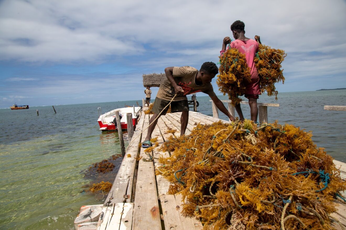
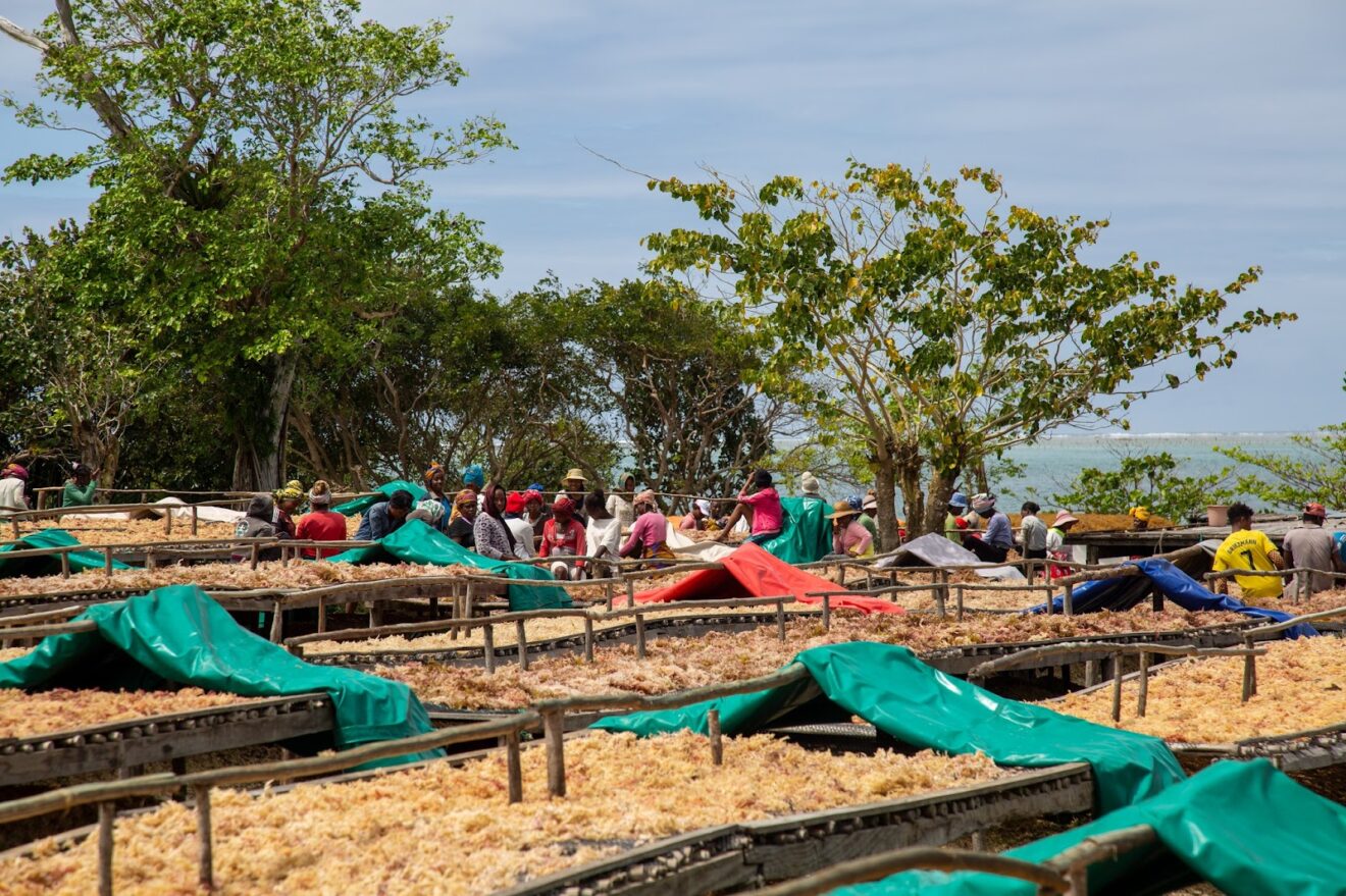
The Wild Region Of Cap Est And The Seaweed Initiative
Once you leave Antalaha and go further south, the paved road turns into a dirt road and gradually becomes muddier and more difficult to drive. Vegetation becomes thicker, and you’ll soon be surrounded by vanilla plantations and green patches of forest with glimpses of the beautiful coastline on the left. After Ambalabe you’ll cross the Onive river by ferry, a true adventure! You’ll then transfer to the small village Ambohitralanana and from here you can go to the most eastern part of Madagascar: Cap Est, also known as Tanjona Angontsy. You’ll find a lighthouse here with great views over the area. There are two or three small very basic hotels here with limited electricity and bucket shower where you can stay overnight. When you’re here you can also visit the algae project.
The Cap Est region, which includes the Cap Est lagoon and the Masoala National Park, is home to the Atsinanana rainforests, listed as World Heritage by UNESCO. This incomparable place, remote and difficult to access, has an exceptional universal biodiversity. The endemicity rate of species in these sites is estimated at an average of 80%, which places this area among the most unique for its biodiversity in the world. Many organizations such as MNP (Madagascar National Park), the Wildlife Conservation Society, Care International or WWF are working to preserve this exceptional environment. Indeed, the Cap Est region is plagued each year by the passage of devastating cyclones and the ancestral slash and burn cultivation (“tavy”) which is just as destructive. These events undermine the protection of this major national park, but also increasingly prevent the subsistence of local communities in these protected areas.
The remoteness of agricultural villages and the lack of adequate road infrastructure is another factor that increases the vulnerability of farmers. In the region, the roads are in poor condition, with many villages having no roads to connect to other villages. Even the main roads are often only accessible during the dry season. The impacts of this isolation are significant, as farmers struggle to obtain agricultural products.
The local algae initiative invests economically and socially in this region in order to offer the villagers new development prospects, less subject to the vagaries of the weather and to ancestral practices that are now harmful to sustainable agriculture.
Removing peasants from deforestation and optimizing working conditions for seaweed cultivation contribute to the protection of the primary forest of the Masoala National Park. There is a forest restoration program by planting native forest species. This aims not only to improve the habitat quality of forest animals, but also to meet the needs of local people for the production of timber and charcoal, through the planting of species at rapid growth.
This new activity of the sea represents an alternative source of income, replacing the deforestation activities of the Cap Est forest and thus allowing nature to regain its rights and rebuild itself naturally.
When you are planning a visit to Sava and if you would like to travel to Cap Est, we can organize a guided tour to the sea
Cap Masoala
Cap Masoala can be reached from Maroantsetra, which is usually done by boat. For those intrepid travelers among us, it is also possible to hike from Antalaha to Cap Masoala or also go by mountain bike or by motorbike.
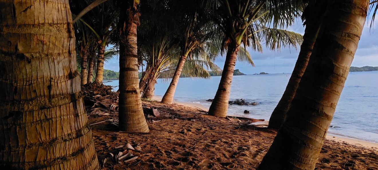
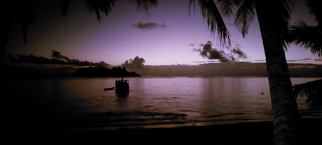
South of Antalaha, the paved road turns into a dirt road and becomes muddier and more difficult to drive. You’ll be driving through patches of forest and vanilla plantations and will have beautiful views on the coastline to your left. After Ambalabe you’ll cross the Onive river by ferry and will then reach Cap Est, where you can stay overnight in a basic local hotel. After Cap Est it is no longer possible to drive by car, so you’ll have to switch to motorbike, bicycle or you’ll go on foot. It is another day of driving all the way to Cap Masoala, crossing several bridges by narrow bridges or by ferry, often without an engine. This is a magnificent part of the island and truly adventurous. After a long journey you’ll reach Cap Masoala, where you’ll have a splendid view over Antongil Bay from under the coconut trees on the beach. There are a few nice lodges here and it’s definitely worth it to stay a few days to explore the area or simply relax.
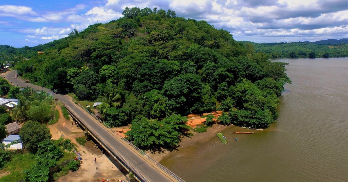
Antongil Bay is located on the northeast coast of the Indian Ocean, measures approximately 60 by 30 kilometers and is part of the Analanjirofo region and the border of the SAVA region. On the east side the bay is bordered by the Masoala peninsula (with the Masoala National Park) and on the north side are the island of Nosy Mangabe and the town of Maroantsetra. The main inflow is the Antainambalana River. In 1642 the VOC founded a trading post on the bay at the behest of governor of Dutch Mauritius Adriaen van der Stel, which was closed again in 1646. Between 1720 and 1735, the bay was the slave trade center of the southwestern Indian Ocean, after which the supply of slaves began to dry up and in the second half of the 18th century, the adventurer Beniowski chose the bay as a base for his activities at the behest of King Louis XV of France. He founded a French colony there, the capital of which he named Louisbourg and was called “Ampansacabe” (“king”) by the locals. Eventually, his activities were eventually no longer supported by the French and in 1776 he left Madagascar.
After helping in the American Revolution and setting up an American-British company to trade with Madagascar with the help of Benjamin Franklin, he returned to the bay in 1784. In 1786, he was killed by French troops led by Bernard Boudin de Tromelin by order of Governor-General of Franco-Mauritius David Charpentier de Cossigny.
There are several coral reefs in Antongil Bay. Dolphins, sea turtles and 13 species of sharks can be found in the bay. The bay is also the most important place in the Eastern Hemisphere for humpback whales to raise their young. Every year between June and September, about 7,000 humpback whales migrate to the bay. During this period you can also regularly hear the mating sound of the male humpback whales over the bay. The bay is therefore also a popular spot for whale watching.
The bay is threatened by local population practices such as shark finning, deforestation along the shore to clear land for agriculture and livestock (zebus), causing soil erosion that threatens water quality, and overfishing. In addition, life in and around the bay is threatened by climate change, leading to global warming, sea level rise and an increasing number of cyclones. The American NGO Wildlife Conservation Society is committed to the bay’s flora and fauna.
Antanetiambo Nature Reserve
Antanetiambo Nature Reserve is a small locally managed forest reserve of 35 acres in the green rice fields only six kilometers outside of Andapa near the Matsobe village, in the north-east of Madagascar in Sava. It is a perfect addition for a one- or two-night stay when you are touring in Sava and to combine with one of the parks in the region.
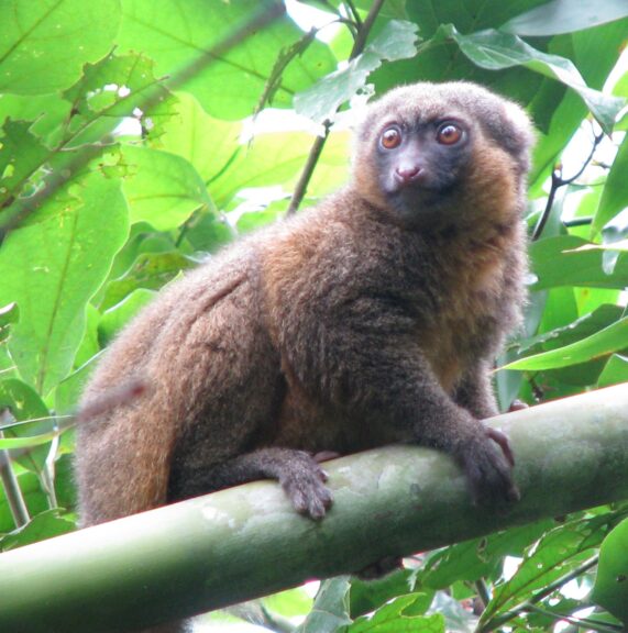
It has been created by a local naturalist and is the perfect spot to not only learn about local fauna and flora, but also about environmentalism and culture while staying at the Antanetiambo Reserve. It is unique in the sense that it has been created by a single local resident and not by a foreign NGO. The reserve gets help from Lemur Conservation Foundation, to develop ecotourism and for the conservation of the bamboo lemurs. There is a fish farming pond, plant nurseries for reforestation, and a community library. You can book a tour to this rainforest reserve with our local agency, starting from Andapa or Sambava.
The region was once covered with tropical rainforest and much of the forest was cut many years ago to farm coffee and other crops, burning down the vegetation. The reserve wants to help the region go back to its former natural state by planting trees and bamboo. The reserve now has mouse lemurs and bamboo lemurs and there are new palissandre, rosewood and ebony trees. We can find many birds such as kingfishers, owls, herons and sunbirds, and a great variety of reptiles and amphibians. This little paradise is surrounded by rice fields and tranquil green landscape.
During your tour to Antanetiambo Reserve you can stay here, eat traditional meals and also get to know more about local spices and crops such as vanilla. During your stay you’ll get to see bamboo lemurs, many types of birds and reptiles and you can ofcourse visit the fish farm, the nurseries, vanilla plantations and rice fields. It’s also possible to go birding in the wetlands of Anjojorobe, go on a pirogue on the Andramonta River, and mountain bike in the countryside. It is possible to rent a tent to camp. If you come here on a tour, your money will be most welcome as the reserve continues to buy new land to expand the forest.
Macolline Reserve Near Antalaha
Macolline is a small reserve of ten hectares on a green hill north of Antalaha. This site was completely deforested and heavily cultivated and has now been reforested again. It is a true example of conservation for the rest of Madagascar. This initiative is working on reforestation of native trees of which tens of thousands of trees has already been planted: around 600 of them endemic, many of them are fruit trees. The park is home to chameleons, lizards, lemurs, butterflies, birds and more. The park has several trails which offer a few hours of hiking through a wonderful landscape with a rich biodiversity. The guides are here to teach local students and visitors about nature and also conservation. The money which comes in, is used for conservation and reforestation. Macolline wants to raise awareness and educate the population about the biodiversity of Madagascar and the region.
Macolline manages the largest collection of endemic and other exotic trees and plants in SAVA and is involved in several ecological projects. The reserve is a place where you can learn about environmental protection and has been working into education and reforestation for over a decade by creating jobs. There is a nearby nursery where trees are growing to use for charcoal. This green charcoal is far more efficient than using precious woods of trees which take decades to centuries to reach their size (ebony, rosewood …) as illegal logging is a major problem in the Sava Region. Besides creating awareness to locals and educating visiting pupils when they come to the Macolline, the project also wants to introduce environmental education in schools, youth groups and outdoor classes.
Marojejy National Park
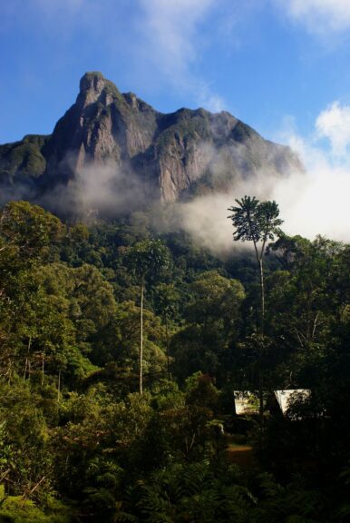
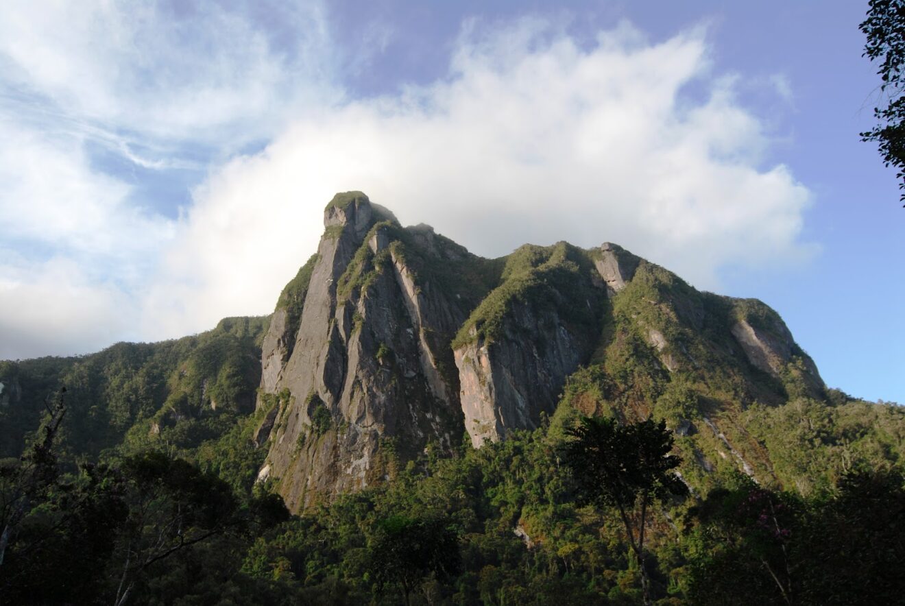
Marojejy is a unique, wild park in the Sava Region of Madagascar. It is a mountainous, rugged park with dense rainforests spread over tall mountains and home to high cliffs, a rich plant and animal life of which many species are endemic to Madagascar and some even endemic to the region.
This beautiful, wild place is located in the jungle between Andapa and Sambava. The Marojejy Massif was first described by prof. Humber in 1948, who was an explorer of mountain ranges all over Africa and a passionate botanist. He described Marojejy as the most impressive mountain range in the country because of its grandeur, its rich flora, and its pristine natural state. His enthusiasm helped Marojejy quickly to become a protected reserve until 1998, after which it became a national park. Before, it was only accessible by researchers, and once it had the status of national park, it is now open to all visitors. Since 2007, Marojejy NP is a UNESCO World Heritage Site because of its biodiversity and stunning landscapes, together with five other national parks which form the “Rainforests of the Atsinanana.”
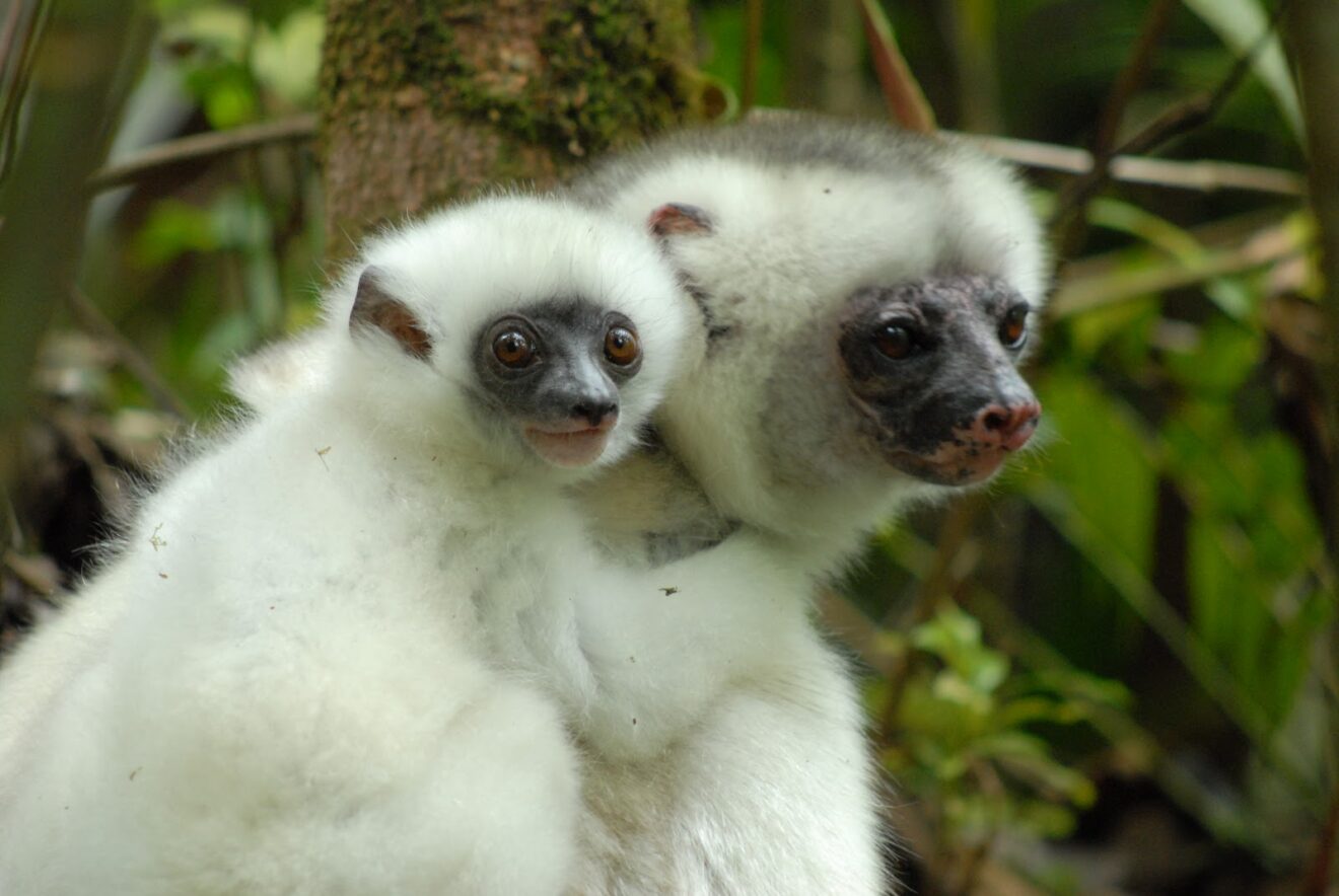
Marojejy National Park is 55,500 hectares big and comprises the entire Marojejy Massif. In the park we find low altitude rainforest to high altitude mountain scrub with a large variety of ferns and scrubs. There are approximately 120 bird species in the park and eleven species of lemurs, including the silky sifaka. We can also find 150 kinds of reptiles and amphibians in the park.
A tour from Marojejy is done from Andapa or Sambava and can be arranged by our local tour agency. A guided visit to Marojejy is an absolute must when you travel to the Sava Region. You can fly to Sambava and then go overland to the park through a beautiful road with scenic views all the way to Andapa, which takes about four hours. From there you’ll continue to the park entrance. The best time to visit is during the drier seasons: April – May and September – December. There are a few tented camps which also have bungalows (Camp Mantella, Camp Marojejia and Camp Simpona) and also several campgrounds in the park and there are several trails starting from Manantenina through the forest and also to the top of the Marojejy summit (2.132 m). In the park you can see several lemur species, birds such as the helmet vanga, frogs, lizards, chameleons and more. The park is also home to the Humber waterfall.
This park is perfect to combine with a visit to Anjanaharibe-Sud, Antanetiambo Nature Reserve and Anolakely Reserve.
Anjanaharibe-Sud
Anjanaharibe-Sud is a national park with 32 km² of mountainous rainforest southwest of Andapa near Marojejy National Park. It is perfect to combine with a visit to Marojejy National Park, although it’s harder to access this park. Due to its location and not receiving too much attention from abroad, there are few visitors who venture here. Those who come here will discover some of the last mid and high primary rainforests, going up to 2.064 meters (Anjanaharibe-Anivo Peak) and will be treated by the great biodiversity of the park, thanks to the different ecosystems, created by the difference in altitude and rainfall. The park is home to rare endemic species, of which some don’t even occur outside of Anjanaharibe Sud and new species are still being discovered.
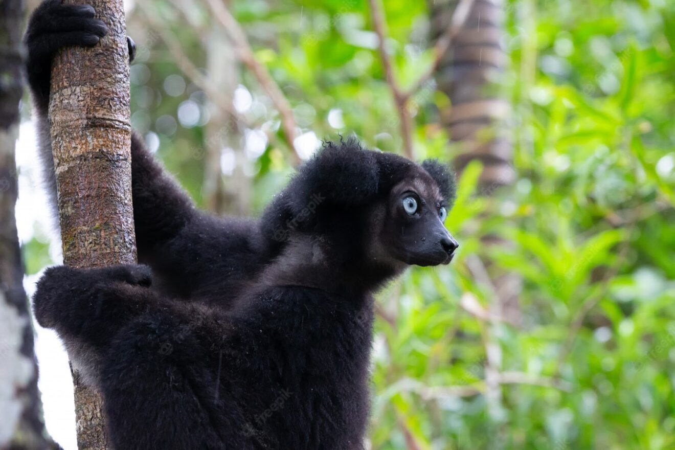
Anjanaharibe Sud is home to twelve lemur species such as the silky sifaka and the indri lemurs, which are almost completely black. There are at least 120 bird species of which several are endemic to the region. A few remarkable birds which can be found at Anjanaharibe Sud are the Madagascar serpent-eagle, red Owl, helmet vanga, red-tailed newtonia, cryptic warbler and several ground-rollers. There are almost 100 kinds of reptiles and amphibians with several rare, endemic frogs and chameleons. In the forest we find many precious woods such as ebony, rosewood, palissandre, mangary, tafonana and vintanona. There is also a wide variety of palm trees. The most famous plant is the Takhtajania tree with aromatic leaves which has been around for 120 million of years!
There are three main circuits which go through the park and accommodation is through camping. The park is accessed by 4×4, starting from Andapa, Sambava or Antalaha, depending on where you’re coming from. It is advised to avoid the heavy rains from January to April.
Humbert Waterfalls
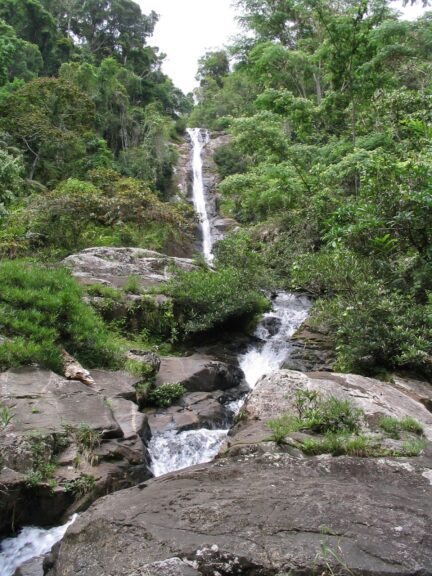
Going up the slopes of the river in Marojejy National Park, we find waterfalls tracing their route through the remnants of vegetation and the bits of intact forest. Professor Humbert was one of the first outsiders who went to explore the Marojejy massif in 1948 and these waterfalls were named after him. They have a forty meters drop and can be found 4 kilometers from the entrance of the park. This is a welcome stop during your hike to refresh yourself and have a picnic.
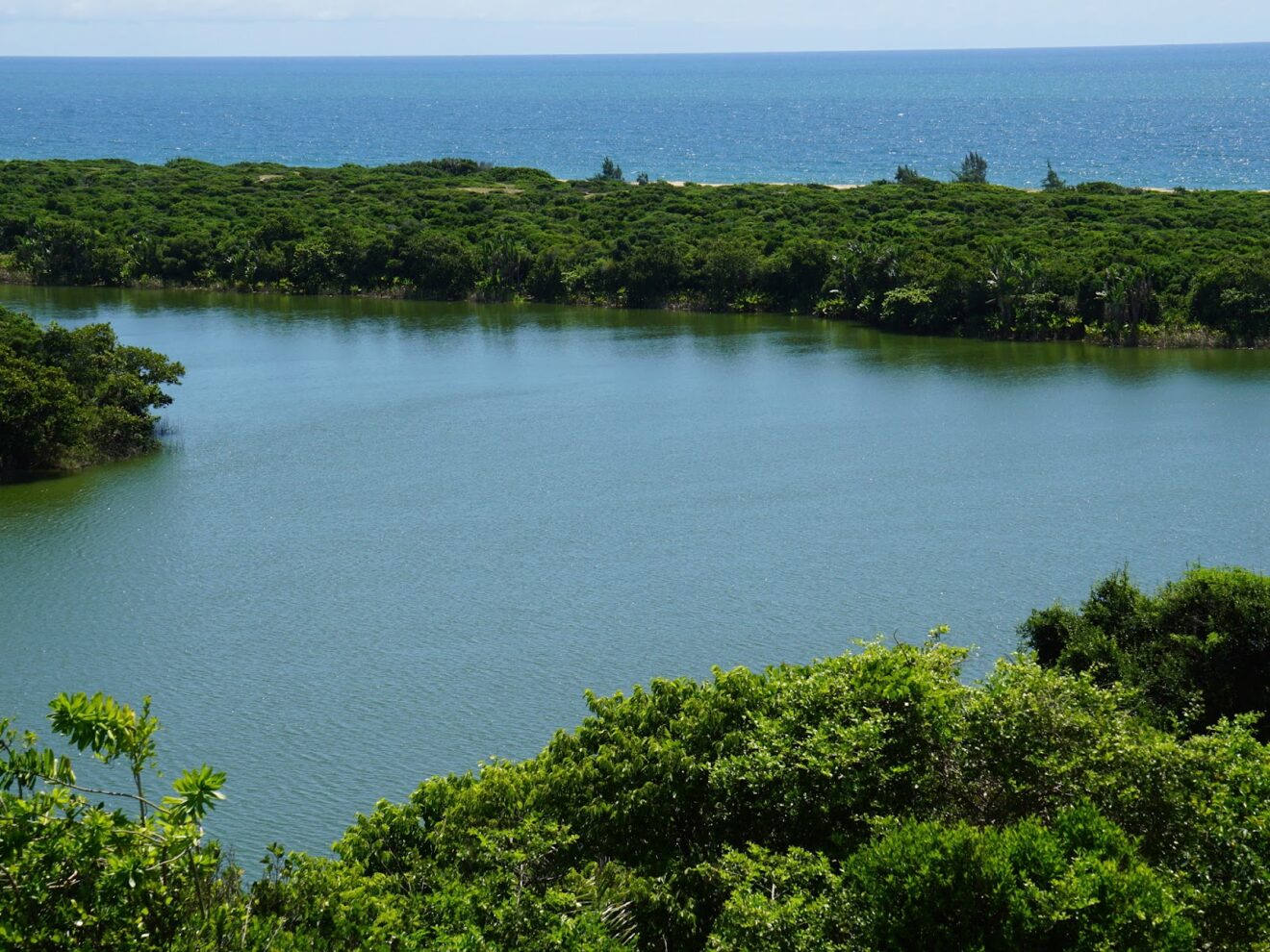
Lac Vert
The Green Lake of Andranotsara can be found near Vohemar. The legend has it that there used to be a village at the site of the lake, but after a dispute between the villagers, a monster with seven heads emerged from the ocean and attacked the village, completely destroying it. The monster then had heavy rains pour down the site, turning it into a lake and the villagers transformed into crocodiles. Many locals see the crocodiles as their ancestors and ask for their blessings during certain ceremonies.
The Green Lake gets its color from the microscopic algae in the water which receive sunlight. In the morning the lake is dark green and at noon it turns to light green as the sun is at its brightest.
Conclusion
As you can notice, the Sava Region has plenty of attractions to offer: wild rugged mountainous parks, deep forests, exotic lemurs, a rich spice tradition, a long green coastline, a welcoming culture and all this in a little-visited region which barely has any visitors. If you have the time, we recommend you start your journey up north in Diego Suarez, visit parks such as Cap d’Ambre, Amber Mountains, Ankarana, Tsingy Rouge and then find your way down and visit Marojejy and Anjanaharibe. Have a stop in Sambava and Antalaha and visit the vanilla fields. If you have enough time and budget, we recommend adding Masoala to your itinerary. Don’t hesitate to contact our agency if you would like to book a tour with us. We can easily make a customized tour for you. For our tours we use good well-mainted 4×4’s, local guides and select the best accommodation, fit to your budget.